LEZÍRIAS ROUTE
Distance: 19.2 km; Duration: 5h;
Degree of Difficulty: Easy
Trail departure point: Jardim do Calvário / Cruz do Calvário
Coordinates: 38.984470, -8.813076
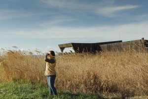
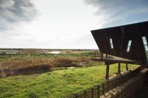
Marked mostly by the waters of the Sorraia and Almansor rivers, this trail cuts across traditional and ancient routes through the floodplains, letting you discover the area’s rich natural and rural heritage against a diverse and dynamic backdrop dotted by urban centres, such as Benavente and Samora Correia.
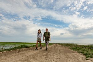
This circular route can begin from Benavente or Samora Correia. In addition to the full trail, you can also do two alternative shorter itineraries. The first circular one begins in Benavente and covers a total of nine kilometres. The second circular one begins in Samora Correia and is 13 kilometres long. Whichever you choose, simply follow the indications on the terrain. You can also do a small segment that is two kilometres long, beginning near the Parque Ribeirinho de Benavente and crossing the Sorraia River over a footbridge until you reach Vala Nova and returning to the starting point.
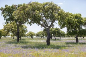
The idea is to follow the route in its entirety, taking the circular option starting in Benavente. The trail begins at Parque Ribeirinho of the Jardim do Cálvario (Riverside Park of the Calvário Garden). This location offers easy parking and has cafeteria and restaurant services in the historical centre where, near the town hall, you can take a look at the local pillory. It was built in 1516, when the new Charter was attributed to Benavente by King D. Manuel I and classified as a building of public interest. In the square you will find one of the highlights of this trail, namely the Cruzeiro do Calvário, which has been classified as building of public interest. Standing in the square with your back to the monument take the street to your right and go all the way down Rua das Acácias. Some 500 metres ahead you will find the national road that crosses the locality; keep going straight ahead on the pavement, going around the car park area. About 400 metres ahead, turn right on to Rua Ladeira dos Carrascos. Keep going for about 200 metres, passing a crossroads, and once you reach a fork in the road take the left-hand fork all the way along Rua Monte da Saúde for 1,500 metres. This street leads to the countryside. You will gradually see fewer houses, and the ones that you do see will be more scattered and surrounded by their vegetable plots and gardens, and then by some farmland. Once you have finished the walk, go along the shoulder of the asphalt road, watching out for traffic. This section leading to the start of the dirt road is about two kilometres long. For the first kilometre, the road crosses a dispersed cork oak grove, with a stone pine forest on the opposite side, while the second kilometre goes along a section of the A10 motorway.
Once you pass the viaduct, at the junction at the end of the descent, turn left, following the final part on asphalt for another 500 metres. At the end of the farmland and at the start of the
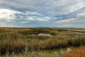
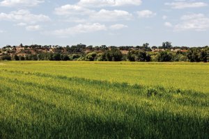
next forest area, turn on to the first dirt road on your right. Open and close the gate or use the walkway next to the electricity pole. Go straight ahead for some 200 metres, turn left next to an agricultural warehouse and go down to the irrigation canal and turn left again. Keep going straight ahead on the path that runs along this hydro-agricultural project for one kilometre. This is where you will have your first contact with the vast flat fields that are typical of this route. Here you may be able to see some blackwinged kites (Elanus caeruleus), which like to hunt in the open fields near the cork oak grove. When the canal ends near the national road, turn right and follow the dirt road through the rice paddies, 1,400 metres ahead. When the dirt road once again approaches the national road, keep going straight ahead and turn right, now going along the Almansor River and always keeping the rice paddies on your right-hand side. Keep going down the road for one kilometre and when you reach one of the floodgates that distribute water to the rice paddies, keep going straight ahead, but now over the earth embankment.
After about 1,500 metres, you will reach the end of this segment that runs alongside the river.
Here you will have the option of visiting Samora Correia. A mere 800 metres ahead you will be able to tour the historical centre where there are various restaurants to choose from. If you decide to do the tour, at this point turn left and cross the bridge, keep going for some 200 metres and then turn on to the first asphalt road on your right; 500 metres ahead you will reach the houses of the Companhia das Lezírias and the local garden.
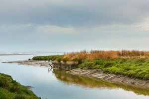
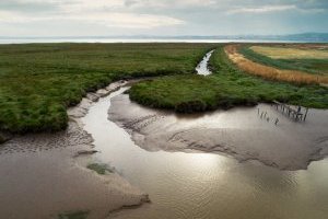
In Samora Correia you will find the Almansor River, its last tributary, flowing into the Tagus River. Over time, it has played a vital role for the region and according to historical records, Romans and Arabs used it as a communication line; it was navigable until the start of the 20th century, with significant river traffic for carrying agricultural and forest products. Along the river you can often see grey herons (Ardea cinerea) or white storks (Ciconia ciconia).
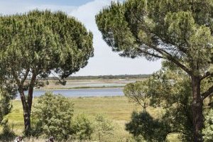
After returning to the previous point, and after once again crossing the bridge over the Almansor River, go past the gate that is ahead of you on a side passage and go over the embankment for some 900 metres. While you are here, take advantage to engage in your first contact with the Sorraia River, which flows for over 150 kilometres. It is the result of the juncture of the Sor and Raia brooks, before receiving water from the Erra, Divôr and Juliano brooks, and passes through Coruche and Benavente. Keep going straight ahead over the dyke along the river for some three kilometres. While on this elevated segment, take the opportunity to admire the view of the vast rice fields that make the municipality of Benavente one of the largest producers of Carolino rice in Portugal. At the end of the road you will once again find the Sorraia Canal, an important part of the irrigation grid for the entire Sorraia Valley. Here, turn left and keep going for three kilometres, always on the path that runs alongside the canal. You will be going underneath the viaduct and shortly thereafter you will find a wooden bridge, which you should ignore because it is part of the shorter alternative
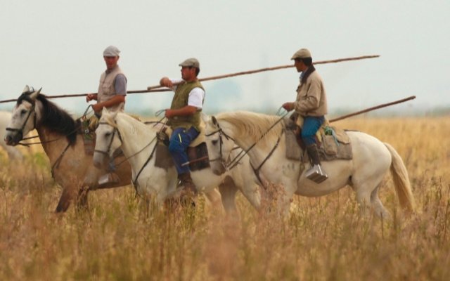
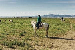
route. Keep going straight ahead along the canal and, after you pass a small tunnel, look out for the fighting bulls which are usually there in an area of open fields. After this, the path becomes narrower, going through a tunnel of dense vegetation where many birds find shelter, brightening up your walk with their singing.
At the end of these three kilometres, you will find a road that crosses the irrigation canal. Keep going straight ahead and after some 100 metres leave the canal, turn left and follow the dirt road, keeping the pine forest on your right and the farmland on your left. In this area you can see the beautiful blackwinged kite, a species that, on the European continent, can only be found in southern Portugal and Spain. After about 400 metres, once you reencounter the renowned Sorraia Canal, continue on the left side on a sandy road, which after 200 metres becomes a narrow path that crosses a small wood.
After crossing the footbridge, turn left and stay on the path that goes around the entire agricultural field. Some 200 metres farther on, leave the path and continue along the embankment for 600 metres, once again with a section of the Sorraia River on your left side. After passing a small cluster of vegetable gardens, go straight ahead and after 300 metres you
will be back to the departure point.
